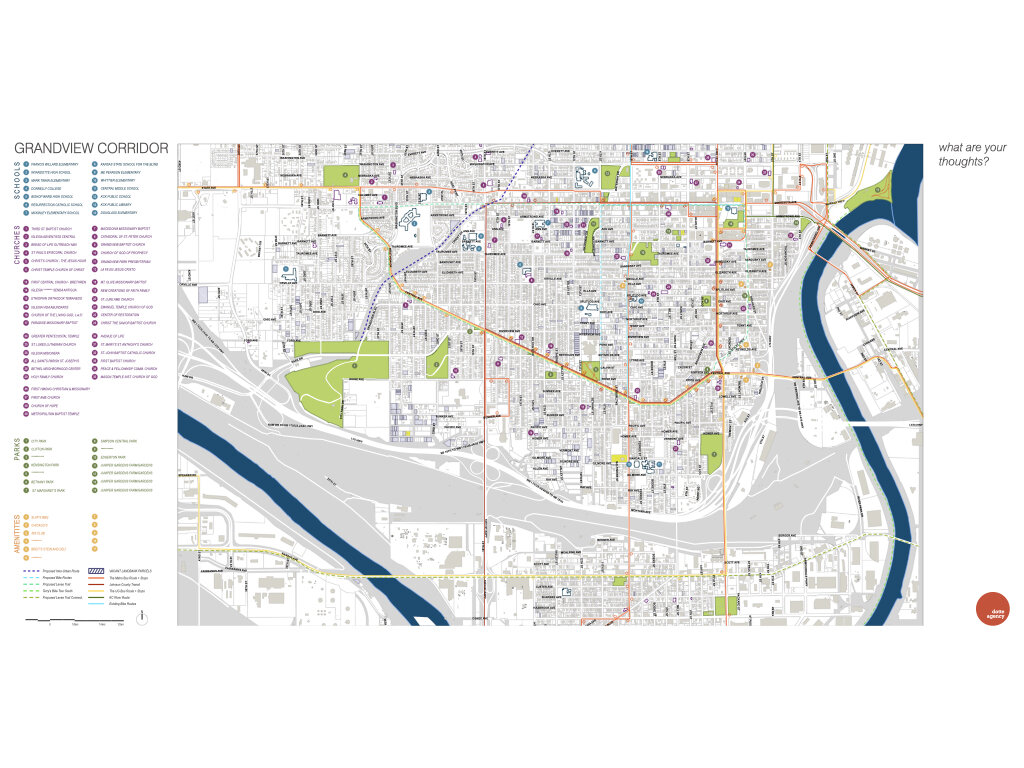
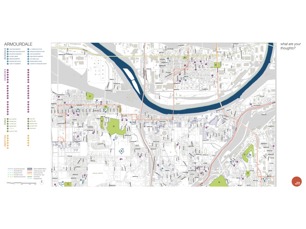
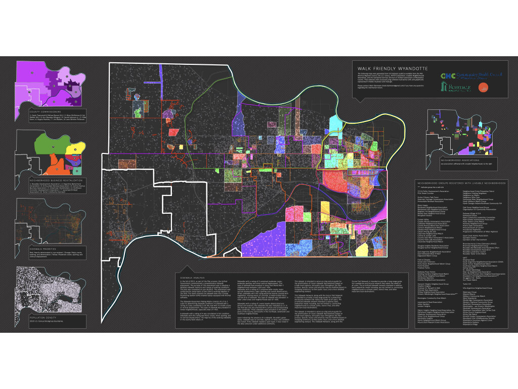
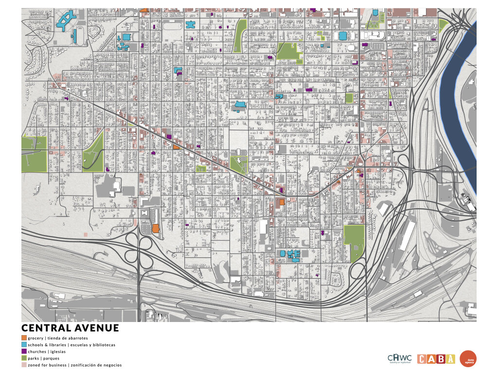
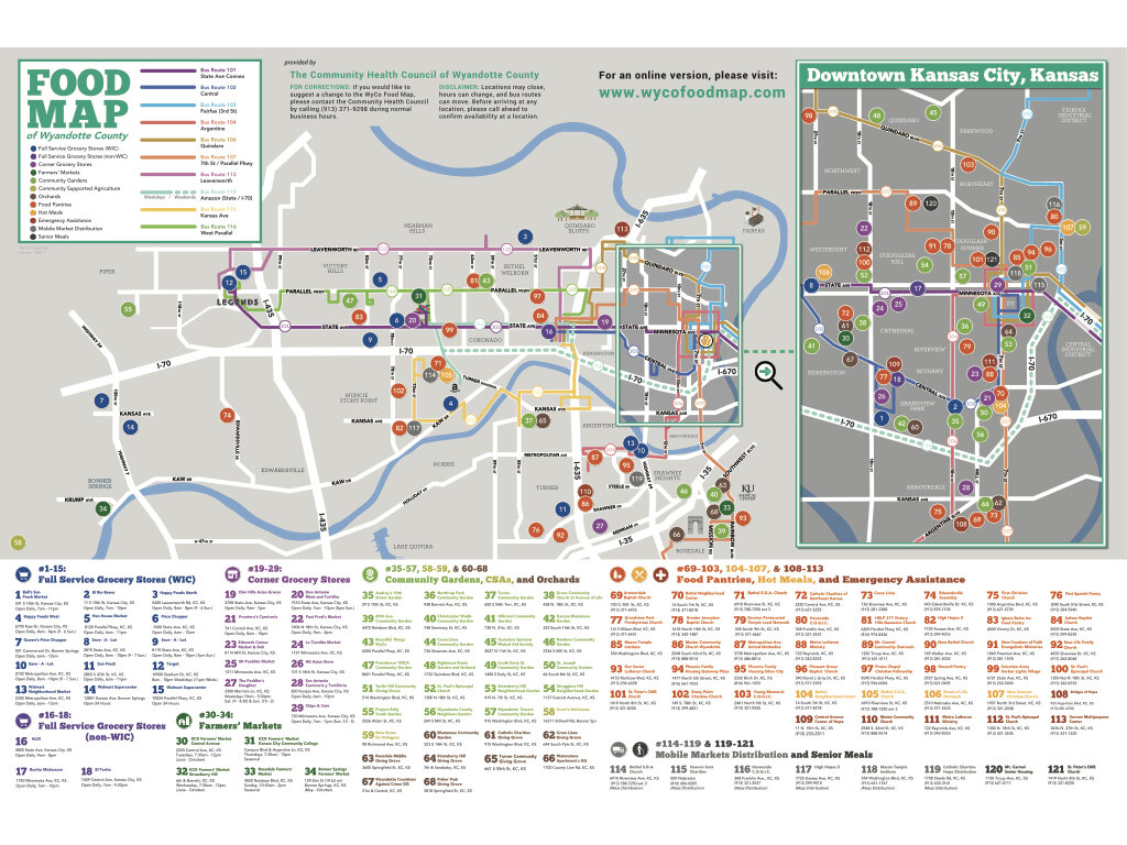
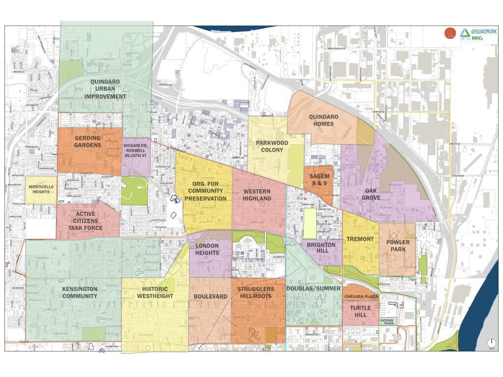
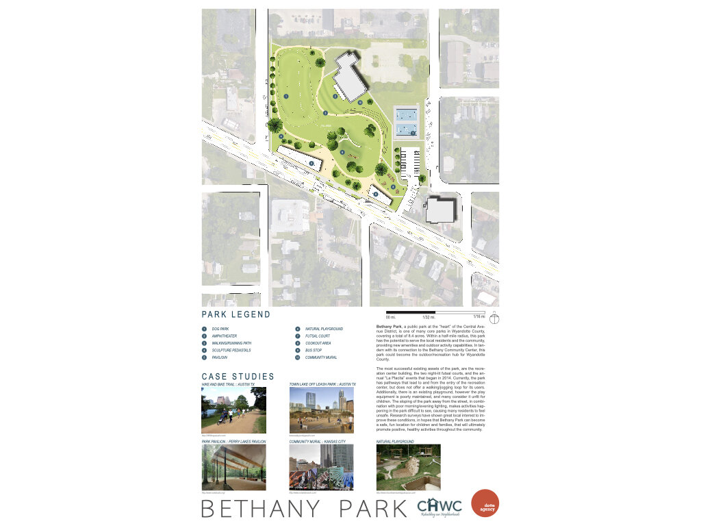
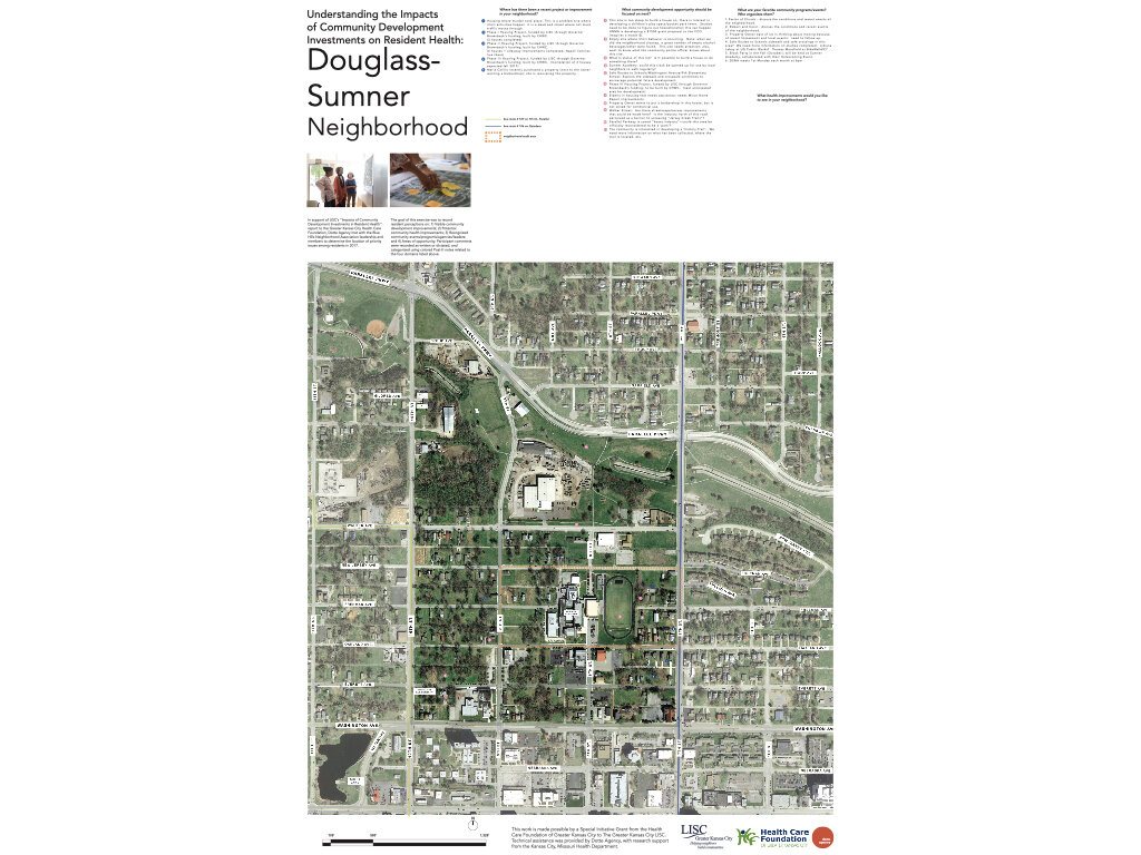
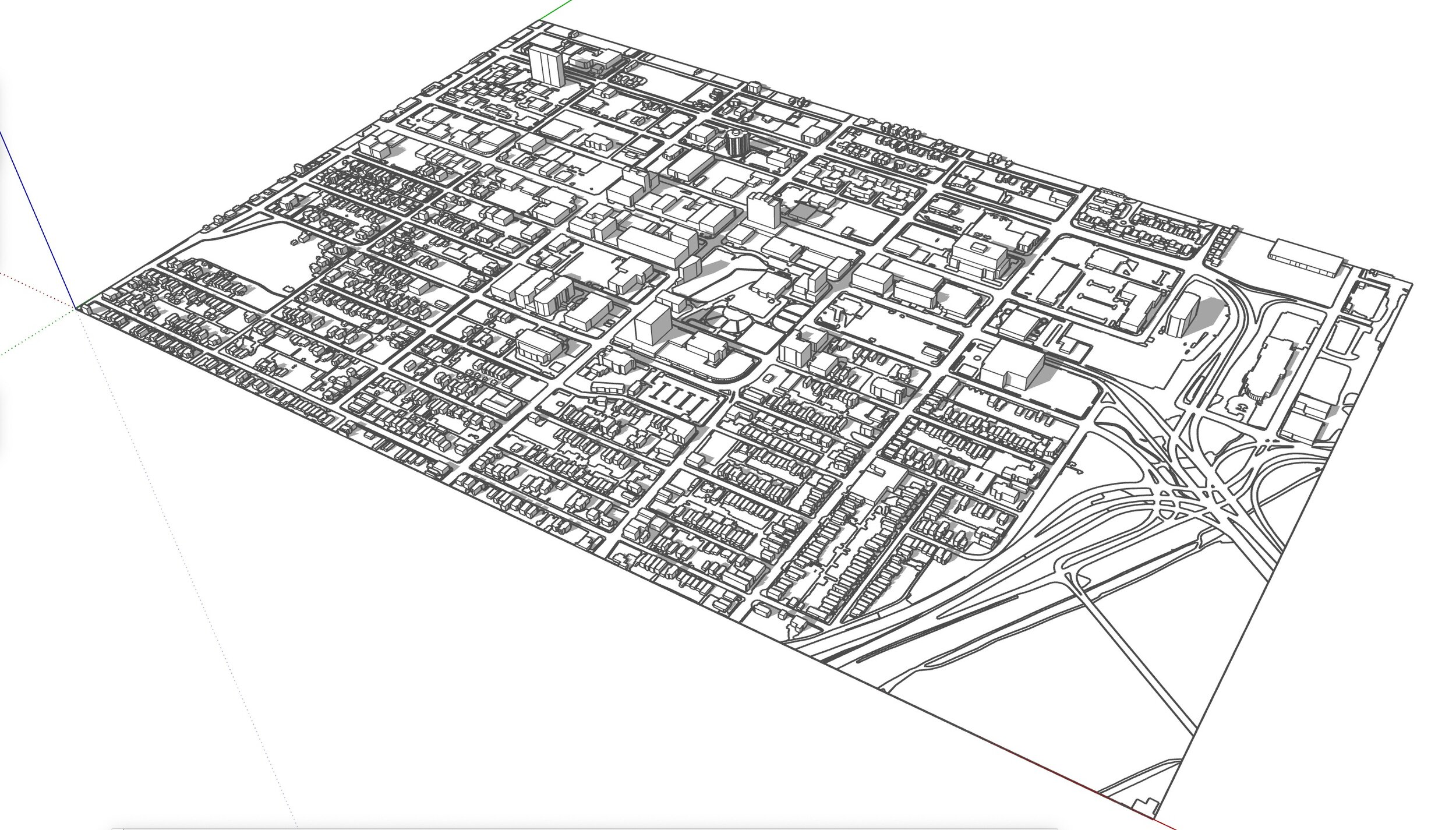
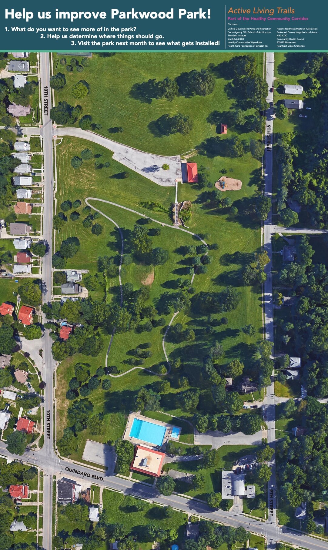
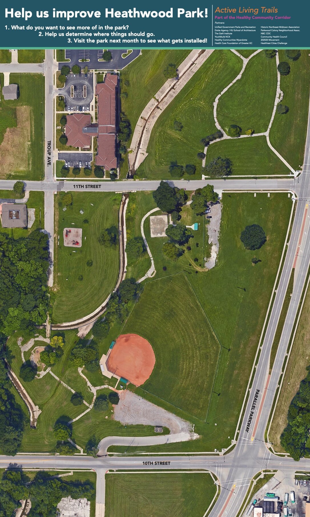
• projects
  • News
  • resources
    • moCOLAB
    • Maps
    • Scholarly Articles
  • About
  • Contact
  • Flipboard
Dotte Agency
  • projects
  • News
  • resources
    • moCOLAB
    • Maps
    • Scholarly Articles
  • About
  • Contact
  • Flipboard

Resources: Maps

Dotte Agency makes no representations or warranties about this data or its content, including, without limitation: accuracy, completeness, or fitness for any purpose. Users of this data do so at their own risk; Dotte Agency will not be liable to any such user for any loss or damage whatsoever. By clicking the image to download a map, you acknowledge that you understand this limitation.

Grandview Corridor
Grandview Corridor
Armourdale
Armourdale
Livable Neighborhoods
Central Avenue
Central Avenue
Jersey Creek Trail
Jersey Creek Trail
Armourdale Levee Trail Phase 1
Parks Proximity
Parks Proximity
Healthy Community Corridor
WyCo Food Map
WyCo Food Map
Northeast KCK Neighborhood Associations
Bethany Park
Bethany Park
Douglass-Sumner Neighborhood
Downtown KCK
Downtown KCK
HOLC "Redlining" map of Kansas City
Metropolitan Ave/Strong Ave Corridor
Waterway, Northrup and Big 11 Parks
WyCo 1885 Map
WyCo 1885 Map
Bird's Eye View 1869
Downtown Sketchup Model
Parkwood Park
Parkwood Park
Screen Shot 2021-05-14 at 1.13.26 PM.jpg

Copyright 2017-2024 • University of Kansas • School of Architecture and Design